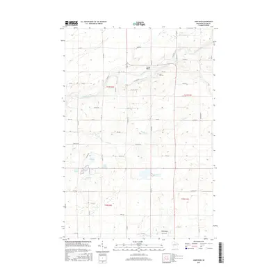
2015 Map of Jump River
USGS Topo · Published 2015About this map
Jump River and Hannibal anchor this rural landscape in Taylor County, where the meandering course of the Jump River defines the central topography. The area is characterized by an extensive system of managed water bodies, including Monson Flowage, Holzer Flowage, and Lake Ellis Flowage 3-3-0.3, which suggest a terrain shaped by local water control and drainage.
Find a feature on this map
44 named features on this map. Tap any name to fly to it.
Don’t see what you’re looking for? This feature index may not catch every label — zoom into the map to look around manually.
Map Details
Editions of this 2015 Jump River Map
This is the sole edition of this map. No revisions or reprints were ever made.
Other maps of this area

1945 · Black River
USGS Topo · 1:48,000

1947 · Sheldon
USGS Topo · 1:48,000

1949 · Sheldon
USGS Topo · 1:48,000

1949 · Jump River Fire Tower
USGS Topo · 1:48,000

1951 · Lublin
USGS Topo · 1:48,000

1951 · Gilman
USGS Topo · 1:62,500

1953 · Rice Lake
USGS Topo · 1:250,000

1959 · Rice Lake
USGS Topo · 1:250,000
1969 · Lublin NW
USGS Topo · 1:24,000
1970 · Jump River Fire Tower NW
USGS Topo · 1:24,000