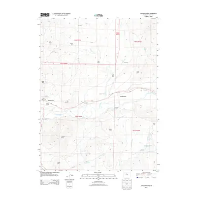
2013 Map of Junction Butte
USGS Topo · Published 2013About this map
The Colorado River winds through the heart of this Grand County landscape, where the confluence with Troublesome Cr and an extensive network of irrigation ditches like the Ennis Ditch and Barger Ditch support a ranching economy. This 2013 survey shows the eastern edge of Kremmling, including the Mc Elroy Airfield and residential streets such as Jackson Ave. The map is characterized by its legacy of named family operations, featuring the Whitaker Ranch, Fay De Berard Ranch, and Bumgarner Ranch along the river valley. Significant high points like Junction Butte and Red Mountain overlook the valley floor, while water management for agricultural use is evident in the presence of the Taussig Reservoir Number 1 and Moore Reservoir. Modern infrastructure is represented by Us-40 and several county roads, providing a clear record of the area's development and land use in the early 21st century.
Find a feature on this map
47 named features on this map. Tap any name to fly to it.
Don’t see what you’re looking for? This feature index may not catch every label — zoom into the map to look around manually.
Map Details
Editions of this 2013 Junction Butte Map
This is the sole edition of this map. No revisions or reprints were ever made.
Other maps of this area

1933 · Mt. Powell
USGS Topo · 1:48,000

1933 · Ute Peak
USGS Topo · 1:62,500

1937 · Ute Peak
USGS Topo · 1:62,500

1940 · Mount Powell
USGS Topo · 1:62,500

1954 · Craig
USGS Topo · 1:250,000

1956 · Kremmling
USGS Topo · 1:62,500

1957 · Craig
USGS Topo · 1:250,000

1957 · Hot Sulphur Springs
USGS Topo · 1:62,500

1957 · Leadville
USGS Topo · 1:250,000

1958 · Craig
USGS Topo · 1:250,000