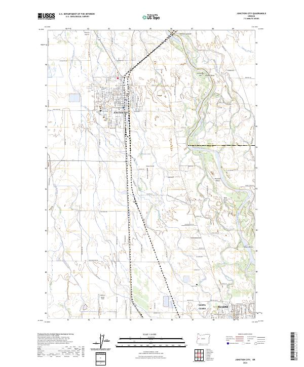
2024 Map of Junction City
USGS Topo · Published 2024About this map
Junction City sits at the heart of this Willamette Valley landscape, where the Portland & Western RR and a grid of rural roads like High Pass RD connect agricultural tracts with the growing northern edge of Eugene. The riverine environment is defined by the shifting course of the Willamette River, which creates complex landforms such as Harrisburg Bend, Harpers Bend, and Marshall Island. These features, alongside several sloughs and bars like Bells Shute Bar, illustrate the dynamic natural history of the valley floor.
Find a feature on this map
119 named features on this map. Tap any name to fly to it.
Don’t see what you’re looking for? This feature index may not catch every label — zoom into the map to look around manually.
Map Details
Editions of this 2024 Junction City Map
This is the sole edition of this map. No revisions or reprints were ever made.
Other maps of this area

1909 · Harrisburg
USGS Topo · 1:31,680

1909 · Rowland
USGS Topo · 1:31,680

1909 · Elmira
USGS Topo · 1:62,500

1910 · Eugene
USGS Topo · 1:62,500

1911 · Monroe
USGS Topo · 1:31,680

1912 · Halsey
USGS Topo · 1:62,500

1922 · Monroe
USGS Topo · 1:62,500

1922 · Elmira
USGS Topo · 1:62,500

1939 · Monroe
USGS Topo · 1:62,500

1940 · Eugene
USGS Topo · 1:62,500