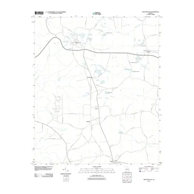
2011 Map of Junction City
USGS Topo · Published 2011About this map
Junction City serves as a central hub in this rural landscape, where local roads like Mock Rd and County Rd-126 connect small communities across the Talbot County countryside. Small settlements such as Brownsand, Norwich, and Howard punctuate the map, the latter featuring the Howard Post Office. The area is defined by a dense network of waterways, including Patsiliga Creek and Black Creek, which have been utilized for recreation and industry through features like Parks Millpond and Watson Millpond.
Find a feature on this map
66 named features on this map. Tap any name to fly to it.
Don’t see what you’re looking for? This feature index may not catch every label — zoom into the map to look around manually.
Map Details
Editions of this 2011 Junction City Map
This is the sole edition of this map. No revisions or reprints were ever made.
Other maps of this area

1907 · Talbotton
USGS Topo · 1:125,000

1950 · Talbotton
USGS Topo · 1:24,000

1950 · Geneva
USGS Topo · 1:24,000

1950 · Buena Vista NE
USGS Topo · 1:24,000

1950 · Buena Vista
USGS Topo · 1:62,500

1950 · Talbotton
USGS Topo · 1:62,500

1955 · Talbotton
USGS Topo · 1:24,000

1955 · Buena Vista NE
USGS Topo · 1:24,000
1955 · Geneva
USGS Topo · 1:24,000
1955 · Talbotton
USGS Topo · 1:62,500