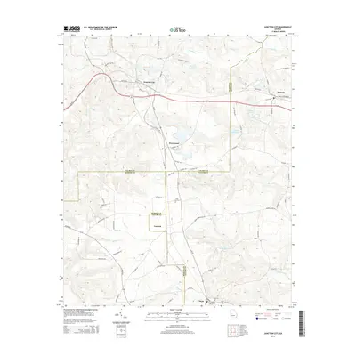
2014 Map of Junction City
USGS Topo · Published 2014About this map
Junction City serves as a central hub in this western Georgia landscape where three counties meet. The convergence of Talbot, Taylor, and Marion counties defines the local administrative boundaries, while the terrain is shaped by the drainage of Patsiliga Cr and Little Whitewater Cr. Transportation and commerce are centered along Ga-96 and Ga-90, connecting small settlements like Howard and Brownsand to the wider region.
Find a feature on this map
79 named features on this map. Tap any name to fly to it.
Don’t see what you’re looking for? This feature index may not catch every label — zoom into the map to look around manually.
Map Details
Editions of this 2014 Junction City Map
This is the sole edition of this map. No revisions or reprints were ever made.
Other maps of this area

1907 · Talbotton
USGS Topo · 1:125,000

1950 · Talbotton
USGS Topo · 1:24,000

1950 · Geneva
USGS Topo · 1:24,000

1950 · Buena Vista NE
USGS Topo · 1:24,000

1950 · Buena Vista
USGS Topo · 1:62,500

1950 · Talbotton
USGS Topo · 1:62,500

1955 · Talbotton
USGS Topo · 1:24,000

1955 · Buena Vista NE
USGS Topo · 1:24,000
1955 · Geneva
USGS Topo · 1:24,000
1955 · Talbotton
USGS Topo · 1:62,500