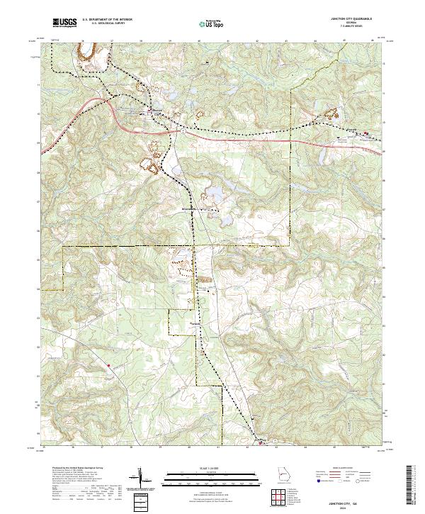
2024 Map of Junction City
USGS Topo · Published 2024About this map
The tri-county intersection of Talbot, Marion, and Taylor counties defines this rural landscape, anchored by the rail and road hubs of Junction City and Howard. The topography is dominated by a complex network of waterways, including Patsiliga Creek and Whitewater Creek, which carve through the terrain to feed reservoirs like Fielder Lake and Parks Millpond. This modern survey illustrates how traditional rural infrastructure persists alongside newer developments, such as the W Fall Line Freeway.
Find a feature on this map
92 named features on this map. Tap any name to fly to it.
Don’t see what you’re looking for? This feature index may not catch every label — zoom into the map to look around manually.
Map Details
Editions of this 2024 Junction City Map
This is the sole edition of this map. No revisions or reprints were ever made.
Other maps of this area

1907 · Talbotton
USGS Topo · 1:125,000

1950 · Talbotton
USGS Topo · 1:24,000

1950 · Geneva
USGS Topo · 1:24,000

1950 · Buena Vista NE
USGS Topo · 1:24,000

1950 · Buena Vista
USGS Topo · 1:62,500

1950 · Talbotton
USGS Topo · 1:62,500

1955 · Talbotton
USGS Topo · 1:24,000

1955 · Buena Vista NE
USGS Topo · 1:24,000
1955 · Geneva
USGS Topo · 1:24,000
1955 · Talbotton
USGS Topo · 1:62,500