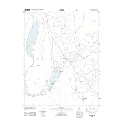
2012 Map of June Lake
USGS Topo · Published 2012About this map
June Lake and its neighboring alpine waters form a chain of glacial basins in the Sierra Nevada, centered here around the community of June Lake and the commercial hub at June Lake Junction. The landscape is dominated by stark volcanic features, including the Mono Craters, the Obsidian Dome, and the Glass Flow, which illustrate the region's complex geological history. Transportation and recreation infrastructure are well-documented, from the Mono Craters Tunnel and W Portal Rd to the extensive recreational facilities at the June Mountain Ski Area and June Mountain Ski Lodge. Numerous campgrounds such as Oh! Ridge Campground and Gull Lake Campground ring the lakes, while the Yost Lake Trailhead provides access to the high backcountry. This survey details the established road network, including Glass Flow Rd and Pumice Mine Rd, which support both tourism and local resource management.
Find a feature on this map
47 named features on this map. Tap any name to fly to it.
Don’t see what you’re looking for? This feature index may not catch every label — zoom into the map to look around manually.
Map Details
Editions of this 2012 June Lake Map
This is the sole edition of this map. No revisions or reprints were ever made.
Other maps of this area

1901 · Mt. Lyell
USGS Topo · 1:125,000

1914 · Mt. Morrison
USGS Topo · 1:125,000

1947 · Mariposa
USGS Topo · 1:250,000

1948 · Mariposa
USGS Topo · 1:250,000

1953 · Mt. Morrison
USGS Topo · 1:62,500

1953 · Mono Craters
USGS Topo · 1:62,500

1953 · Devils Postpile
USGS Topo · 1:62,500

1957 · Mariposa
USGS Topo · 1:250,000

1962 · Cowtrack Mtn
USGS Topo · 1:62,500

1963 · Mariposa
USGS Topo · 1:250,000