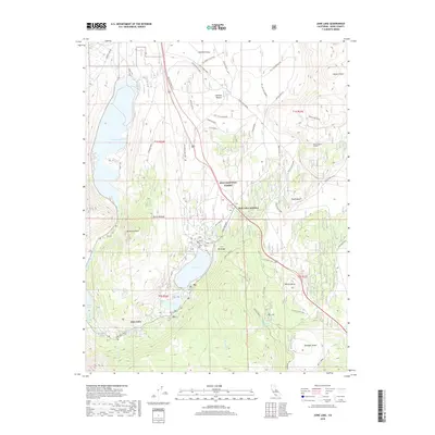
2018 Map of June Lake
USGS Topo · Published 2018About this map
The mountain resort community of June Lake is the primary focus of this study, positioned along the iconic June Lake Loop. This glacial landscape, shaped by the Sierra Nevada range, includes a chain of significant water bodies including Grant Lake, Gull Lake, and Silver Lake. The topography is marked by striking volcanic features such as Obsidian Dome, Wilson Butte, and the Aeolian Buttes, which rise above the sandy floor of Pumice Valley.
Find a feature on this map
46 named features on this map. Tap any name to fly to it.
Don’t see what you’re looking for? This feature index may not catch every label — zoom into the map to look around manually.
Map Details
Editions of this 2018 June Lake Map
This is the sole edition of this map. No revisions or reprints were ever made.
Other maps of this area

1901 · Mt. Lyell
USGS Topo · 1:125,000

1914 · Mt. Morrison
USGS Topo · 1:125,000

1947 · Mariposa
USGS Topo · 1:250,000

1948 · Mariposa
USGS Topo · 1:250,000

1953 · Mt. Morrison
USGS Topo · 1:62,500

1953 · Mono Craters
USGS Topo · 1:62,500

1953 · Devils Postpile
USGS Topo · 1:62,500

1957 · Mariposa
USGS Topo · 1:250,000

1962 · Cowtrack Mtn
USGS Topo · 1:62,500

1963 · Mariposa
USGS Topo · 1:250,000