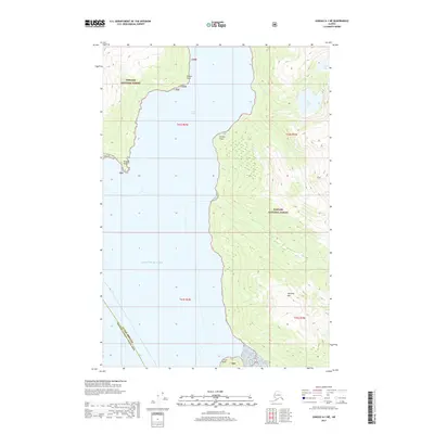
2017 Map of Juneau A-1 NE
USGS Topo · Published 2017About this map
Tongass National Forest dominates this coastal landscape, where steep terrain meets the waters of the Gulf of Alaska. The map centers on the dramatic corridor of Taku Inlet, a glacial fjord flanked by prominent landmarks such as Cooper Point, Greely Point, and Bishop Point. This 2017 survey illustrates the intersection of maritime navigation and terrestrial elevation, with Williams Mtn rising sharply to the east of the inlet.
Find a feature on this map
18 named features on this map. Tap any name to fly to it.
Don’t see what you’re looking for? This feature index may not catch every label — zoom into the map to look around manually.
Map Details
Editions of this 2017 Juneau A-1 NE Map
This is the sole edition of this map. No revisions or reprints were ever made.
Other maps of this area

1948 · Juneau B-1
USGS Topo · 1:63,360

1951 · Juneau
USGS Topo · 1:250,000

1951 · Taku River B-6
USGS Topo · 1:63,360

1951 · Taku River A-6
USGS Topo · 1:63,360

1951 · Juneau A-1
USGS Topo · 1:63,360

1952 · Juneau B-1
USGS Topo · 1:63,360

1953 · Taku River
USGS Topo · 1:250,000

1954 · Juneau A-1
USGS Topo · 1:63,360

1960 · Taku River
USGS Topo · 1:250,000

1962 · Juneau
USGS Topo · 1:250,000