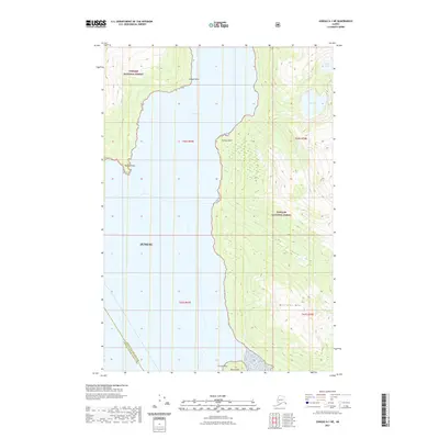
2021 Map of Juneau A-1 NE
USGS Topo · Published 2021About this map
Taku Inlet dominates this coastal landscape, cutting a deep channel through the coastal mountains of the Tongass National Forest. The map illustrates a dramatic maritime environment where steep ridgelines, including Williams Mtn and Butler Peak, drop sharply toward the waterline. Navigation points such as Bishop Point, Greely Point, and Cooper Point define the rugged shoreline, marking the intersection of the glacial waters and the dense forest. Inland, the hydrology is characterized by high-elevation water bodies like Bart Lake and Lieuy Lake, which feed smaller drainage systems like Dorothy Cr. This survey captures the wilderness character of the Juneau City and Borough Hoonah-Angoon Census Area boundary, showing an area defined by topography rather than human settlement.
Find a feature on this map
17 named features on this map. Tap any name to fly to it.
Don’t see what you’re looking for? This feature index may not catch every label — zoom into the map to look around manually.
Map Details
Editions of this 2021 Juneau A-1 NE Map
This is the sole edition of this map. No revisions or reprints were ever made.
Other maps of this area

1948 · Juneau B-1
USGS Topo · 1:63,360

1951 · Juneau
USGS Topo · 1:250,000

1951 · Taku River B-6
USGS Topo · 1:63,360

1951 · Taku River A-6
USGS Topo · 1:63,360

1951 · Juneau A-1
USGS Topo · 1:63,360

1952 · Juneau B-1
USGS Topo · 1:63,360

1953 · Taku River
USGS Topo · 1:250,000

1954 · Juneau A-1
USGS Topo · 1:63,360

1960 · Taku River
USGS Topo · 1:250,000

1962 · Juneau
USGS Topo · 1:250,000