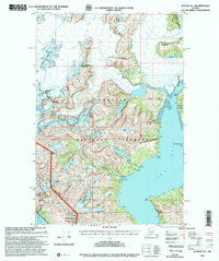
1997 Map of Juneau B-1
USGS Topo · Published 2000About this map
The Taku Inlet and its surrounding icefields dominate this landscape, where massive glacial formations like the Taku Glacier and Norris Glacier meet the sea. During the late 1990s, the industrial and maritime character of the region is evident in the presence of the Power Plant at Annex Creek and the small settlement at Thane along the Gastineau Channel. This area served as a critical corridor for resource extraction and utility infrastructure, as evidenced by the multiple Mines and Prospects scattered across the mountain ridges. Remote outposts such as the Taku Glacier Cabin and Portal Camp provided essential shelter for forest service personnel and surveyors. The topographic detail captures the steep transition from the tidewater of Sunny Cove to the high alpine peaks of Hawthorne Peak and Martin Peak.
Find a feature on this map
71 named features on this map. Tap any name to fly to it.
Don’t see what you’re looking for? This feature index may not catch every label — zoom into the map to look around manually.
Map Details
Editions of this 1997 Juneau B-1 Map
This is the sole edition of this map. No revisions or reprints were ever made.
Other maps of this area

1947 · Juneau B-2
USGS Topo · 1:63,360

1948 · Juneau B-1
USGS Topo · 1:63,360

1949 · Juneau B-2
USGS Topo · 1:62,500

1951 · Juneau
USGS Topo · 1:250,000

1951 · Taku River B-6
USGS Topo · 1:63,360

1951 · Taku River A-6
USGS Topo · 1:63,360

1951 · Juneau A-2
USGS Topo · 1:63,360

1951 · Juneau A-1
USGS Topo · 1:63,360

1952 · Juneau B-1
USGS Topo · 1:63,360

1953 · Taku River
USGS Topo · 1:250,000