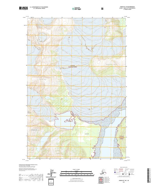
2021 Map of Juneau B-1 NE
USGS Topo · Published 2021About this map
Tongass National Forest dominates this Alaskan landscape, where glacial action and high-elevation terrain define the geography. The presence of the Hole-in-the-Wall Glacier in the northeast corner highlights the active cryosphere of the region, feeding meltwater into local systems. Hydrological features like Oona Lake, Loon Lakes, and Glory Lake are set against prominent peaks such as Norris Mtn and Thoroughfare Mtn. Along the coastal and riverine margins, specialized terrain features including Grizzly Bar and Oozy Flat suggest the complex depositional environment found near Taku Point. This 2021 survey provides a modern baseline for tracking ice retreat and shoreline changes along the Norris-Taku Ridge and the Coast Mountain range.
Find a feature on this map
19 named features on this map. Tap any name to fly to it.
Don’t see what you’re looking for? This feature index may not catch every label — zoom into the map to look around manually.
Map Details
Editions of this 2021 Juneau B-1 NE Map
This is the sole edition of this map. No revisions or reprints were ever made.
Other maps of this area

1948 · Juneau B-1
USGS Topo · 1:63,360

1951 · Juneau
USGS Topo · 1:250,000

1951 · Taku River B-6
USGS Topo · 1:63,360

1952 · Juneau B-1
USGS Topo · 1:63,360

1953 · Taku River
USGS Topo · 1:250,000

1960 · Taku River C-6
USGS Topo · 1:63,360

1960 · Juneau C-1
USGS Topo · 1:63,360

1960 · Taku River
USGS Topo · 1:250,000

1962 · Juneau
USGS Topo · 1:250,000
1986 · Juneau B-1 SW
USGS Topo · 1:25,000