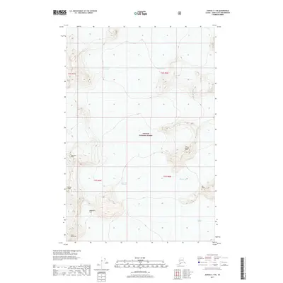
2017 Map of Juneau C-1 NE
USGS Topo · Published 2017About this map
Hole-in-the-Wall Glacier and Demorest Glacier dominate this high-elevation landscape within the Tongass National Forest, showcasing the icefield dynamics of the northern Coast Mountains. The terrain is defined by extreme relief, where dramatic summits like Floprock Peak and Vantage Peak rise above deep catchments such as Washington Basin. This map reflects the state of the ice at the start of the twenty-first century, even noting an Unknown Glacier in the southeastern reaches. The network of ridges, including Ivy Ridge and the aptly named The Scatter Peaks, illustrates a wilderness largely untouched by human infrastructure, where geography is dictated entirely by glacial flow and tectonic uplift.
Find a feature on this map
14 named features on this map. Tap any name to fly to it.
Don’t see what you’re looking for? This feature index may not catch every label — zoom into the map to look around manually.
Map Details
Editions of this 2017 Juneau C-1 NE Map
This is the sole edition of this map. No revisions or reprints were ever made.
Other maps of this area

1951 · Juneau
USGS Topo · 1:250,000

1953 · Taku River
USGS Topo · 1:250,000

1960 · Taku River C-6
USGS Topo · 1:63,360

1960 · Juneau D-1
USGS Topo · 1:63,360

1960 · Juneau C-1
USGS Topo · 1:63,360

1960 · Taku River
USGS Topo · 1:250,000

1962 · Juneau
USGS Topo · 1:250,000

1995 · Taku River C-6
USGS Topo · 1:63,360
2017 · Taku River C-6 SW
USGS Topo · 1:25,000
2017 · Juneau C-1 SE
USGS Topo · 1:25,000