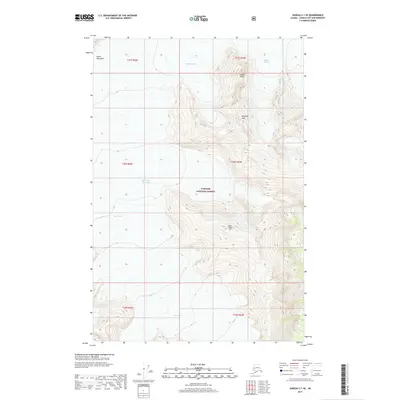
2017 Map of Juneau C-1 SE
USGS Topo · Published 2017About this map
Taku Glacier dominates the western portion of this 2017 survey, representing one of the most prominent ice flows within the Tongass National Forest. The map documents a high-altitude landscape where massive ice fields converge among the Coast Mountains, featuring several distinct glacial systems including Demorest Glacier and the curiously named Hole-in-the-Wall Glacier. To the east, the terrain rises sharply toward peaks and ridges such as Hodgkins Peak and Goat Ridge, which define the drainage basins for smaller watercourses like Sockeye Cr. This modern USGS study provides precise contour data for the Organ Pipes and other high-relief landmarks, offering a clear record of the area's glacial extent and mountain topography at the beginning of the twenty-first century.
Find a feature on this map
10 named features on this map. Tap any name to fly to it.
Don’t see what you’re looking for? This feature index may not catch every label — zoom into the map to look around manually.
Map Details
Editions of this 2017 Juneau C-1 SE Map
This is the sole edition of this map. No revisions or reprints were ever made.
Other maps of this area

1948 · Juneau B-1
USGS Topo · 1:63,360

1951 · Juneau
USGS Topo · 1:250,000

1951 · Taku River B-6
USGS Topo · 1:63,360

1952 · Juneau B-1
USGS Topo · 1:63,360

1953 · Taku River
USGS Topo · 1:250,000

1960 · Taku River C-6
USGS Topo · 1:63,360

1960 · Juneau C-1
USGS Topo · 1:63,360

1960 · Taku River
USGS Topo · 1:250,000

1962 · Juneau
USGS Topo · 1:250,000

1994 · Taku River B-6
USGS Topo · 1:63,360