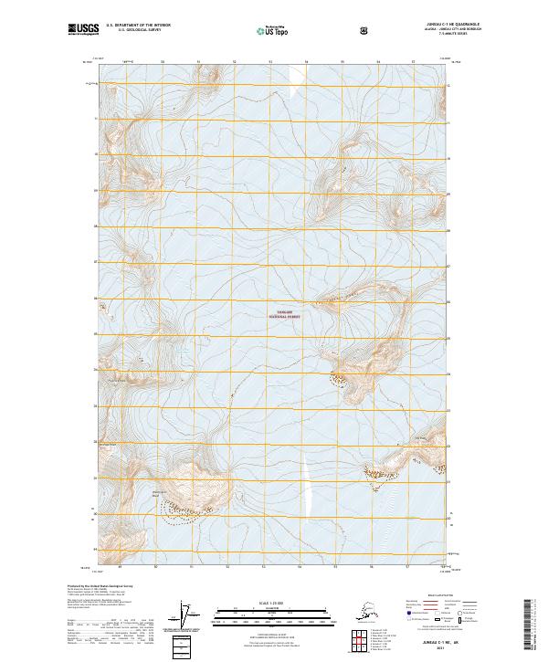
2021 Map of Juneau C-1 NE
USGS Topo · Published 2021About this map
Tongass National Forest encompasses this high-altitude Alaskan landscape, where extreme topography is defined by unnamed ice fields and prominent summits. The northern reaches of the map are dominated by the Unknown Glacier, a massive frozen expanse that feeds the surrounding watershed. To the south, the terrain breaks into a series of jagged landmarks including The Scatter Peaks and Floprock Peak. This 2021 survey provides a contemporary record of glacial extent and alpine features within the Juneau Borough, capturing the orientation of Vantage Peak and Ivy Ridge above the secluded Washington Basin. The map serves as a vital document for understanding the modern state of remote coastal mountains in Southeast Alaska.
Find a feature on this map
11 named features on this map. Tap any name to fly to it.
Don’t see what you’re looking for? This feature index may not catch every label — zoom into the map to look around manually.
Map Details
Editions of this 2021 Juneau C-1 NE Map
This is the sole edition of this map. No revisions or reprints were ever made.
Other maps of this area

1951 · Juneau
USGS Topo · 1:250,000

1953 · Taku River
USGS Topo · 1:250,000

1960 · Taku River C-6
USGS Topo · 1:63,360

1960 · Juneau D-1
USGS Topo · 1:63,360

1960 · Juneau C-1
USGS Topo · 1:63,360

1960 · Taku River
USGS Topo · 1:250,000

1962 · Juneau
USGS Topo · 1:250,000

1995 · Taku River C-6
USGS Topo · 1:63,360
2017 · Taku River C-6 SW
USGS Topo · 1:25,000
2017 · Juneau C-1 SE
USGS Topo · 1:25,000