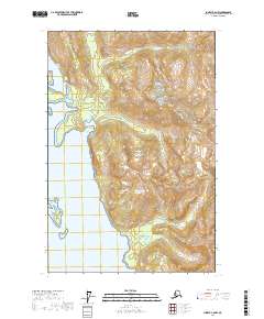
2017 Map of Juneau C-6 NW
USGS Topo · Published 2017About this map
Glacier Bay National Park dominates this coastal landscape in the Hoonah-Angoon region, where the steep terrain of the Fairweather Range meets the inlets of the Inside Passage. The map details a complex shoreline characterized by several protected anchorages, including Sandy Cove and North Sandy Cove, which are separated by a prominent peninsula. To the south, the Leland Islands sit just offshore, providing a natural break for the waters of Spokane Cove.
Find a feature on this map
12 named features on this map. Tap any name to fly to it.
Don’t see what you’re looking for? This feature index may not catch every label — zoom into the map to look around manually.
Map Details
Editions of this 2017 Juneau C-6 NW Map
This is the sole edition of this map. No revisions or reprints were ever made.
Other maps of this area

1948 · Juneau C-6
USGS Topo · 1:63,360

1948 · Mount Fairweather D-1
USGS Topo · 1:63,360

1948 · Mount Fairweather C-1
USGS Topo · 1:63,360

1949 · Mount Fairweather C-1
USGS Topo · 1:63,360

1949 · Juneau D-6
USGS Topo · 1:63,360

1950 · Juneau C-6
USGS Topo · 1:63,360

1951 · Juneau
USGS Topo · 1:250,000

1951 · Mt Fairweather
USGS Topo · 1:250,000

1954 · Mount Fairweather D-1
USGS Topo · 1:63,360

1961 · Mt Fairweather
USGS Topo · 1:250,000