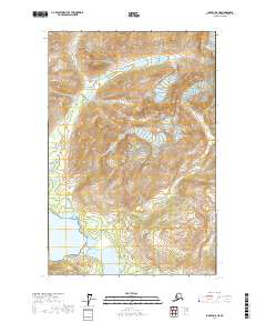
2017 Map of Juneau D-6 NE
USGS Topo · Published 2017About this map
Glacier Bay National Park dominates this remote landscape within the Hoonah-Angoon Census Area, showcasing the dramatic ice and water features of southeastern Alaska. The map traces the reach of the Girdled Glacier as it feeds into the surrounding topography, with prominent peaks like Berg Mtn rising above the glacial valleys. The drainage patterns are clearly defined by the paths of Berg Creek, which flows through the expansive Main Valley toward the coast.
Find a feature on this map
11 named features on this map. Tap any name to fly to it.
Don’t see what you’re looking for? This feature index may not catch every label — zoom into the map to look around manually.
Map Details
Editions of this 2017 Juneau D-6 NE Map
This is the sole edition of this map. No revisions or reprints were ever made.
Other maps of this area

1949 · Juneau D-6
USGS Topo · 1:63,360

1949 · Juneau D-5
USGS Topo · 1:63,360

1951 · Juneau
USGS Topo · 1:250,000

1952 · Skagway
USGS Topo · 1:250,000

1954 · Skagway A-3
USGS Topo · 1:63,360

1954 · Skagway A-2
USGS Topo · 1:63,360

1961 · Skagway
USGS Topo · 1:250,000

1962 · Juneau
USGS Topo · 1:250,000
1996 · Juneau D-5
USGS Topo · 1:63,360
2004 · Skagway A-2
USGS Topo · 1:63,360