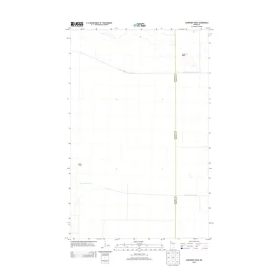
2013 Map of Juneberry Ridge
USGS Topo · Published 2013About this map
Juneberry Ridge rises slightly above the flat, marshy expanse of this borderland region in the northernmost reaches of Minnesota. The landscape is defined by the strict geometry of early 20th-century water management projects, illustrated by the long, straight channels of State Ditch Number Seventy-two and State Ditch Number Fifty. These engineering works, cutting across the terrain, reveal the intensive effort to drain these northern wetlands for agricultural or navigational purposes. Near the western edge, the land curves at Moose Point, providing one of the few natural topographic variations in a territory dominated by man-made waterways. The map also delineates the boundary where Kittson County and Roseau County meet, showing how political lines bisect this sparsely settled wetland environment.
Find a feature on this map
5 named features on this map. Tap any name to fly to it.
Don’t see what you’re looking for? This feature index may not catch every label — zoom into the map to look around manually.
Map Details
Editions of this 2013 Juneberry Ridge Map
This is the sole edition of this map. No revisions or reprints were ever made.
Other maps of this area

1918 · Hemmington
USGS Topo · 1:62,500

1919 · Pelan
USGS Topo · 1:62,500

1930 · Juneberry
USGS Topo · 1:31,680

1932 · Juneberry
USGS Topo · 1:62,500

1952 · Thief River Falls
USGS Topo · 1:250,000

1956 · Thief River Falls
USGS Topo · 1:250,000

1956 · Karlstad
USGS Topo · 1:62,500

1957 · Thief River Falls
USGS Topo · 1:250,000

1957 · Pelan
USGS Topo · 1:62,500

1966 · Caribou
USGS Topo · 1:24,000