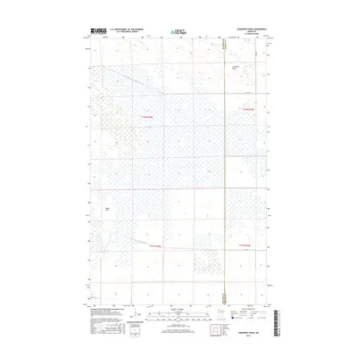
2016 Map of Juneberry Ridge
USGS Topo · Published 2016About this map
Juneberry Ridge and Moose Point define the subtle topography of this northern landscape near the border of Roseau and Kittson counties. The map reveals an extensive system of water management essential for the region, characterized by long, engineered waterways such as State Ditch Number Seventy-two and State Ditch Number Fifty. These features illustrate the historical effort to drain the marshy terrain of the Red River Valley for agricultural use and settlement. The rural infrastructure is represented by a grid of local routes, including Co Hwy 7 and Co Rd 24, which provide access to the remote sections of these borderlands. This 2016 survey documents the enduring spatial organization of the Public Land Survey System, marked by township boundaries like t162n r45w and t162n r44w, which continue to shape the development and property lines of this northwestern Minnesota region.
Find a feature on this map
14 named features on this map. Tap any name to fly to it.
Don’t see what you’re looking for? This feature index may not catch every label — zoom into the map to look around manually.
Map Details
Editions of this 2016 Juneberry Ridge Map
This is the sole edition of this map. No revisions or reprints were ever made.
Other maps of this area

1918 · Hemmington
USGS Topo · 1:62,500

1919 · Pelan
USGS Topo · 1:62,500

1930 · Juneberry
USGS Topo · 1:31,680

1932 · Juneberry
USGS Topo · 1:62,500

1952 · Thief River Falls
USGS Topo · 1:250,000

1956 · Thief River Falls
USGS Topo · 1:250,000

1956 · Karlstad
USGS Topo · 1:62,500

1957 · Thief River Falls
USGS Topo · 1:250,000

1957 · Pelan
USGS Topo · 1:62,500

1966 · Caribou
USGS Topo · 1:24,000