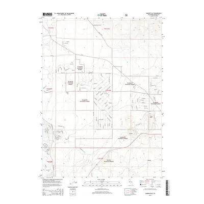
2015 Map of Juniper Flat
USGS Topo · Published 2015About this map
Klamath National Forest and Shasta National Forest meet in this high-altitude landscape of northern Siskiyou County, where volcanic geography and ranching legacy define the terrain. The area is marked by prominent landforms such as Yellow Butte and the distinctive summit of Haystack, while the drainage of Whitney Cr and Graham Cr carves through the southern sections. This 2015 study captures the modern layout of the high desert plateau, showing the settlement at Juniper Flat and the small station of Bolam along the southern edge. The map reveals a dense network of residential and ranch roads, including Harry Cash Rd and Lost Mine Rd, which branch out across the basin towards Coonrod Ranch Airport. This convergence of public forest land and private ranching interests illustrates the enduring character of this Siskiyou County region.
Find a feature on this map
77 named features on this map. Tap any name to fly to it.
Don’t see what you’re looking for? This feature index may not catch every label — zoom into the map to look around manually.
Map Details
Editions of this 2015 Juniper Flat Map
This is the sole edition of this map. No revisions or reprints were ever made.
Other maps of this area

1886 · Shasta
USGS Topo · 1:250,000

1894 · Shasta
USGS Topo · 1:250,000

1921 · Shasta Valley Sheet No 11
USGS Topo · 1:24,000

1922 · Shasta Valley Sheet No 10
USGS Topo · 1:24,000

1922 · Shasta Valley Sheet No 10 E
USGS Topo · 1:24,000

1922 · Shasta Valley Sheet No 9
USGS Topo · 1:24,000

1934 · Macdoel
USGS Topo · 1:96,000

1935 · Dunsmuir
USGS Topo · 1:125,000

1941 · Macdoel
USGS Topo · 1:125,000

1948 · Weed
USGS Topo · 1:250,000