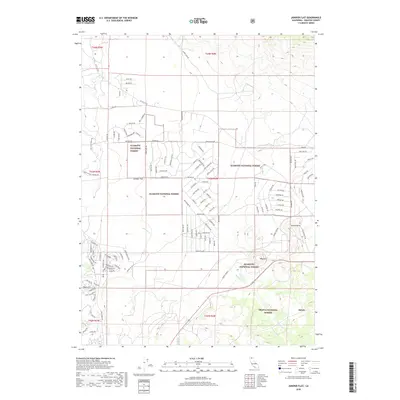
2018 Map of Juniper Flat
USGS Topo · Published 2018About this map
Juniper Flat serves as a focal point for this survey of the high desert and forest interface in Siskiyou County. The landscape is defined by the transition between the Klamath National Forest and the Shasta National Forest, where volcanic features like Yellow Butte and the Haystack rise above the alluvial plains. Water is a defining seasonal element here, with Whitney Cr and Graham Cr cutting through the terrain. The map details a complex network of rural and forest service routes, from the long-distance 99-97 Cutoff and Hwy A12 to residential clusters like those found along Juniper Terrace. For those studying the northern California backcountry, the proximity of the rail-side settlement at Bolam and features like Barnum Cave provide specific points of interest within this high-elevation environment.
Find a feature on this map
108 named features on this map. Tap any name to fly to it.
Don’t see what you’re looking for? This feature index may not catch every label — zoom into the map to look around manually.
Map Details
Editions of this 2018 Juniper Flat Map
This is the sole edition of this map. No revisions or reprints were ever made.
Other maps of this area

1886 · Shasta
USGS Topo · 1:250,000

1894 · Shasta
USGS Topo · 1:250,000

1921 · Shasta Valley Sheet No 11
USGS Topo · 1:24,000

1922 · Shasta Valley Sheet No 10
USGS Topo · 1:24,000

1922 · Shasta Valley Sheet No 10 E
USGS Topo · 1:24,000

1922 · Shasta Valley Sheet No 9
USGS Topo · 1:24,000

1934 · Macdoel
USGS Topo · 1:96,000

1935 · Dunsmuir
USGS Topo · 1:125,000

1941 · Macdoel
USGS Topo · 1:125,000

1948 · Weed
USGS Topo · 1:250,000