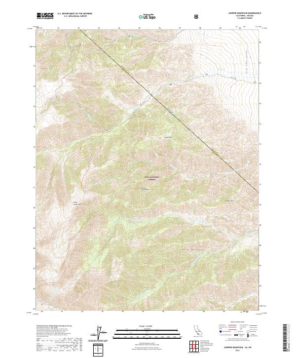
2021 Map of Juniper Mountain
USGS Topo · Published 2021About this map
Inyo National Forest dominates this high-altitude landscape where the White-Inyo Range meets the Fish Lake Valley. The terrain is defined by a series of steep drainages including Leidy Creek, Busher Cr, and the various forks of Perry Aiken Cr, which cut through the complex topography of the White Mountains. The map illustrates the historical movement of livestock and travelers through the region via the Leidy Creek Stock Trl and Leidy Creek Trl, which navigate the slopes toward Pinyon Mtn. Notable elevations include Juniper Mtn and the broad expanse of Perry Aiken Flat. This 2021 survey also documents the precise administrative intersection of the Nevada-California state line and the Esmeralda-Mono county boundary as they traverse these remote peaks.
Find a feature on this map
27 named features on this map. Tap any name to fly to it.
Don’t see what you’re looking for? This feature index may not catch every label — zoom into the map to look around manually.
Map Details
Editions of this 2021 Juniper Mountain Map
This is the sole edition of this map. No revisions or reprints were ever made.
Other maps of this area

1917 · White Mountain
USGS Topo · 1:125,000

1947 · Mariposa
USGS Topo · 1:250,000

1948 · Mariposa
USGS Topo · 1:250,000

1957 · Mariposa
USGS Topo · 1:250,000

1962 · Benton
USGS Topo · 1:62,500

1962 · Mt. Barcroft
USGS Topo · 1:62,500

1962 · White Mtn. Peak
USGS Topo · 1:62,500

1963 · Mariposa
USGS Topo · 1:250,000

1963 · Davis Mountain
USGS Topo · 1:62,500
1987 · East of Davis Mtn.
USGS Topo · 1:24,000