
1919 Map of Junipero Serra
USGS Topo · Published 1919About this map
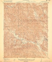
The Santa Barbara National Forest defines the interior landscape of this 1919 survey, characterized by the steep verticality of the Santa Lucia Range. Settlement in this period was sparse, consisting primarily of isolated outposts like Abbott Ranch, Herbert Ranch, and Rancho Escondido. The map records a curious cluster of activity at The Indians and a nearby Bee Industry, reflecting the small-scale agricultural and ranching operations that relied on the seasonal flows of the San Antonio River and the Nacimiento River. In the southeast, the presence of the Milpitas School and the Milpitas Ditch indicates a localized community center and water management system serving the ranching families near the San Miguelito boundary. High-elevation markers including Junipero Serra Pk 5844 and Cone Peak 5155 provide critical reference points for the early forest administration managed from the Santa Lucia Ranger Sta.
Find a feature on this map
36 named features on this map. Tap any name to fly to it.
Don’t see what you’re looking for? This feature index may not catch every label — zoom into the map to look around manually.
Map Details
Editions of this 1919 Junipero Serra Map
5 editions found
Other maps of this area

1912 · Metz
USGS Topo · 1:31,680

1915 · Soledad
USGS Topo · 1:62,500

1919 · King City
USGS Topo · 1:62,500

1919 · Bryson
USGS Topo · 1:62,500

1920 · Jamesburg
USGS Topo · 1:48,000

1921 · Cape San Martin
USGS Topo · 1:62,500

1921 · Jamesburg
USGS Topo · 1:62,500

1921 · Metz
USGS Topo · 1:62,500

1921 · Lucia
USGS Topo · 1:62,500

1939 · King City
USGS Topo · 1:62,500