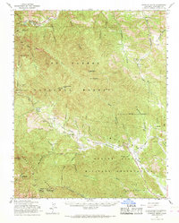
1961 Map of Junipero Serra
USGS Topo · Published 1968About this map
Junipero Serra Peak dominates this section of the Santa Lucia Range, rising above a landscape defined by the expansive Los Padres National Forest and the Hunter Liggett Military Reservation. The map captures a transition from the wild, high-elevation terrain near Cone Peak Lookout Tower to the more developed ranching and military lands in the southeast.
Find a feature on this map
51 named features on this map. Tap any name to fly to it.
Don’t see what you’re looking for? This feature index may not catch every label — zoom into the map to look around manually.
Map Details
Editions of this 1961 Junipero Serra Map
2 editions found
Other maps of this area

1912 · Metz
USGS Topo · 1:31,680

1915 · Soledad
USGS Topo · 1:62,500

1919 · King City
USGS Topo · 1:62,500

1919 · Junipero Serra
USGS Topo · 1:62,500

1919 · Bryson
USGS Topo · 1:62,500

1920 · Jamesburg
USGS Topo · 1:48,000

1921 · Cape San Martin
USGS Topo · 1:62,500

1921 · Jamesburg
USGS Topo · 1:62,500

1921 · Metz
USGS Topo · 1:62,500

1921 · Lucia
USGS Topo · 1:62,500