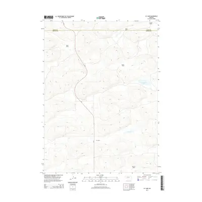
2014 Map of K C Lake
USGS Topo · Published 2014About this map
The Nebraska Sandhills define this portion of the High Plains, where the landscape is marked by a series of northwest-to-southeast trending depressions. These lowlands, such as Winslow Valley and Deans Valley, characterize the northern reaches near the boundary between Grant and Arthur counties. The absence of established settlements highlights the isolated, pastoral nature of the region, where land use is dictated by the availability of water in an otherwise semi-arid environment. Central to the map's geography is the Ne-61 corridor, providing the primary north-south transit across this undulating terrain. Local hydrology is represented by isolated water bodies including Sand Puddin Lake and the namesake K C Lake, which anchors the lower elevations of K C Valley. Other named features like Collins Valley and Nostrum Valley provide essential points of reference for researchers and local historians studying the ranching history of the area.
Find a feature on this map
10 named features on this map. Tap any name to fly to it.
Don’t see what you’re looking for? This feature index may not catch every label — zoom into the map to look around manually.
Map Details
Editions of this 2014 K C Lake Map
This is the sole edition of this map. No revisions or reprints were ever made.
Other maps of this area

1948 · George Lake
USGS Topo · 1:62,500

1948 · Spring Valley
USGS Topo · 1:62,500

1949 · Arthur
USGS Topo · 1:62,500

1950 · Spring Valley
USGS Topo · 1:62,500

1950 · Velma
USGS Topo · 1:62,500

1950 · George Lake
USGS Topo · 1:62,500

1950 · Arthur
USGS Topo · 1:62,500

1954 · North Platte
USGS Topo · 1:250,000

1956 · North Platte
USGS Topo · 1:250,000

1957 · North Platte
USGS Topo · 1:250,000