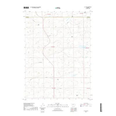
2017 Map of K C Lake
USGS Topo · Published 2017About this map
K C Valley and its namesake K C Lake define this high plains landscape along the Grant and Arthur County line. The terrain is characterized by a series of deep depressions and basins that shelter small water bodies, including Sand Puddin Lake and the Three Tanks Lakes. This 2017 survey reveals a sparsely populated ranching region where local transit depends on a network of named section roads, such as Rothwell Rd, Kramer Rd, and Dancer Rd. Named for prominent local families or early settlers, basins like Nostrum Valley, Hobin Valley, and Collins Valley provide a sense of the genealogy and land use history of this Nebraska Sandhills territory. The map serves as a detailed record of the specific topography and land divisions that have shaped life in Arthur and Grant counties for generations.
Find a feature on this map
21 named features on this map. Tap any name to fly to it.
Don’t see what you’re looking for? This feature index may not catch every label — zoom into the map to look around manually.
Map Details
Editions of this 2017 K C Lake Map
This is the sole edition of this map. No revisions or reprints were ever made.
Other maps of this area

1948 · George Lake
USGS Topo · 1:62,500

1948 · Spring Valley
USGS Topo · 1:62,500

1949 · Arthur
USGS Topo · 1:62,500

1950 · Spring Valley
USGS Topo · 1:62,500

1950 · Velma
USGS Topo · 1:62,500

1950 · George Lake
USGS Topo · 1:62,500

1950 · Arthur
USGS Topo · 1:62,500

1954 · North Platte
USGS Topo · 1:250,000

1956 · North Platte
USGS Topo · 1:250,000

1957 · North Platte
USGS Topo · 1:250,000