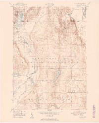
1951 Map of K P Lake
USGS Topo · Published 1951About this map
The northern reaches of the Camp Grayling (Michigan National Guard) dominate the lower half of this landscape, where the military reservation boundary intersects the varied glacial terrain of the Au Sable River valley. This 1951 survey documents a transition between active military training grounds and protected wilderness areas like the Pigeon River State Forest in the northwest. High points such as Redner Hill and Lothrop Hill overlook a dense network of water bodies, including the central K P Lake, Little K P Lake, and Jones Lake. The map reveals the early infrastructure of the region, featuring County Road 612 and several named routes like Briggs Road and Kinney Road that weave through the forest and around the Otsego and Crawford County line.
Find a feature on this map
35 named features on this map. Tap any name to fly to it.
Don’t see what you’re looking for? This feature index may not catch every label — zoom into the map to look around manually.
Map Details
Editions of this 1951 K P Lake Map
3 editions found
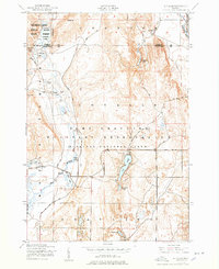
Other maps of this area

1949 · Lewiston
USGS Topo · 1:62,500

1949 · Otsego Lake
USGS Topo · 1:62,500

1949 · Grayling
USGS Topo · 1:62,500

1950 · Grayling
USGS Topo · 1:24,000

1950 · Johannesburg
USGS Topo · 1:24,000

1950 · Lovells
USGS Topo · 1:24,000

1950 · Turtle Lake
USGS Topo · 1:24,000

1951 · K P Lake
USGS Topo · 1:24,000

1951 · Big Bradford Lake
USGS Topo · 1:24,000

1951 · Lovells
USGS Topo · 1:24,000
Featured Places
- Chester Township, MI
- Lovells Township, MI
- Grayling Charter Township, MI
- Maple Forest Township, MI
- Otsego Lake Township, MI