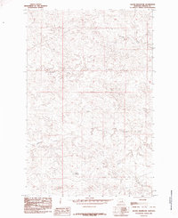
1985 Map of Kachia Reservoir
USGS Topo · Published 1985About this map
Kachia Reservoir sits at the heart of this Fergus County landscape, anchoring a network of drainages and small-scale water management features typical of the Montana plains in the late 1970s. The topography is dominated by the meandering course of the Sacagawea River, which carves through the central portion of the sheet. Further north, the terrain is defined by the winding path of Little Crooked Creek, while Antelope Creek cuts across the southern reaches. This provisional survey captures the area’s water resources just before the mid-1980s, including the smaller Harr Reservoir. The map reflects a sparsely populated ranching or grazing environment where named water bodies and reservoirs serve as the primary landmarks and vital infrastructure for the local land use of the era.
Find a feature on this map
5 named features on this map. Tap any name to fly to it.
Don’t see what you’re looking for? This feature index may not catch every label — zoom into the map to look around manually.
Map Details
Editions of this 1985 Kachia Reservoir Map
This is the sole edition of this map. No revisions or reprints were ever made.
Other maps of this area

1943 · Landusky
USGS Topo · 1:125,000

1954 · Hessler Ridge
USGS Topo · 1:24,000

1954 · Carter Coulee
USGS Topo · 1:24,000

1954 · Lewistown
USGS Topo · 1:250,000

1959 · Lewistown
USGS Topo · 1:250,000

1971 · Kepple Bottoms
USGS Topo · 1:24,000

1984 · Zortman
USGS Topo · 1:100,000

1985 · Bear Creek Reservoir SE
USGS Topo · 1:24,000

1985 · Valentine
USGS Topo · 1:24,000

1985 · Sloan Reservoir
USGS Topo · 1:24,000