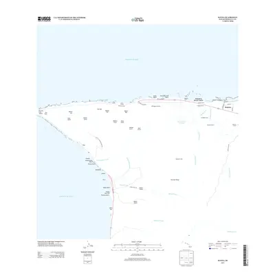
2013 Map of Kaena
USGS Topo · Published 2013About this map
Mokulē‘ia Beach Colony and the nearby Dillingham Airfield anchor this coastal segment of the Wai‘anae Range. The landscape is defined by its series of pali (cliffs) and gulches, including Manini Pali and Keekee Gulch, which drop sharply toward the Pacific Ocean. This 2013 survey illustrates a distinct land-use pattern where established agricultural and equestrian operations like Dillingham Ranch, Crowbar Ranch, and Campbell Ranch coexist with recreational and military sites.
Find a feature on this map
62 named features on this map. Tap any name to fly to it.
Don’t see what you’re looking for? This feature index may not catch every label — zoom into the map to look around manually.
Map Details
Editions of this 2013 Kaena Map
This is the sole edition of this map. No revisions or reprints were ever made.
Other maps of this area

1952 · Waimea
USGS Topo · 1:24,000

1953 · Haleiwa
USGS Topo · 1:24,000

1953 · Schofield Barracks
USGS Topo · 1:24,000

1954 · Oahu
USGS Topo · 1:250,000

1954 · Waianae
USGS Topo · 1:24,000

1954 · Kaena
USGS Topo · 1:24,000

1960 · Haleiwa
USGS Topo · 1:24,000

1960 · Schofield Barracks
USGS Topo · 1:24,000

1961 · Oahu
USGS Topo · 1:250,000
1963 · Waianae
USGS Topo · 1:24,000