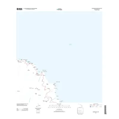
2013 Map of Kahakuloa
USGS Topo · Published 2013About this map
The settlement of Kahakuloa serves as the focal point for this coastal study of Northwest Maui, situated where the Kahakuloa Stream meets the sea. The landscape is defined by a succession of steep gulches and coastal points, from Poelua Bay in the west to the prominent Kahakuloa Head and Pu'u Koa'e overlooking the bay. This era of the island's geography shows the winding path of the Kahekili Hwy as it navigates the dramatic elevation changes of Kaukini Ridge and Maunakini. Offshore, the presence of Mōke'ehia Island and Hulu Island highlights the island's jagged volcanic perimeter. The concentration of gulches like Wailena Gulch and Makamakaole Stream illustrates the heavy erosion patterns and hydrological network typical of the island's windward slopes.
Find a feature on this map
50 named features on this map. Tap any name to fly to it.
Don’t see what you’re looking for? This feature index may not catch every label — zoom into the map to look around manually.
Map Details
Editions of this 2013 Kahakuloa Map
This is the sole edition of this map. No revisions or reprints were ever made.
Other maps of this area

1954 · Maui
USGS Topo · 1:250,000

1954 · Paia
USGS Topo · 1:24,000

1955 · Wailuku
USGS Topo · 1:24,000

1955 · Kahakuloa
USGS Topo · 1:24,000

1956 · Lahaina
USGS Topo · 1:24,000

1956 · Honolua
USGS Topo · 1:24,000

1966 · Maui
USGS Topo · 1:250,000

1974 · Maui
USGS Topo · 1:250,000
1977 · Paia
USGS Topo · 1:24,000

1977 · Wailuku
USGS Topo · 1:24,000