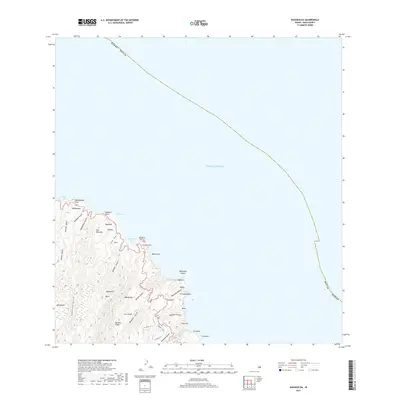
2017 Map of Kahakuloa
USGS Topo · Published 2017About this map
The coastal cliffs and deeply incised gulches of North Maui define this topography, where the land drops precipitously into the Pacific Ocean. High-profile landmarks like Kahakuloa Head Puu Koae and Mokeehia Island stand as sentinels along a shoreline shaped by Kahakuloa Bay and Poelua Bay. Inland, the terrain is a complex network of drainage systems including Kahakuloa Stream and Makamakaole Stream, which carve through the volcanic landscape between prominent features like Kaukini Ridge and Puu Haunako.
Find a feature on this map
48 named features on this map. Tap any name to fly to it.
Don’t see what you’re looking for? This feature index may not catch every label — zoom into the map to look around manually.
Map Details
Editions of this 2017 Kahakuloa Map
This is the sole edition of this map. No revisions or reprints were ever made.
Other maps of this area

1954 · Maui
USGS Topo · 1:250,000

1954 · Paia
USGS Topo · 1:24,000

1955 · Wailuku
USGS Topo · 1:24,000

1955 · Kahakuloa
USGS Topo · 1:24,000

1956 · Lahaina
USGS Topo · 1:24,000

1956 · Honolua
USGS Topo · 1:24,000

1966 · Maui
USGS Topo · 1:250,000

1974 · Maui
USGS Topo · 1:250,000
1977 · Paia
USGS Topo · 1:24,000

1977 · Wailuku
USGS Topo · 1:24,000