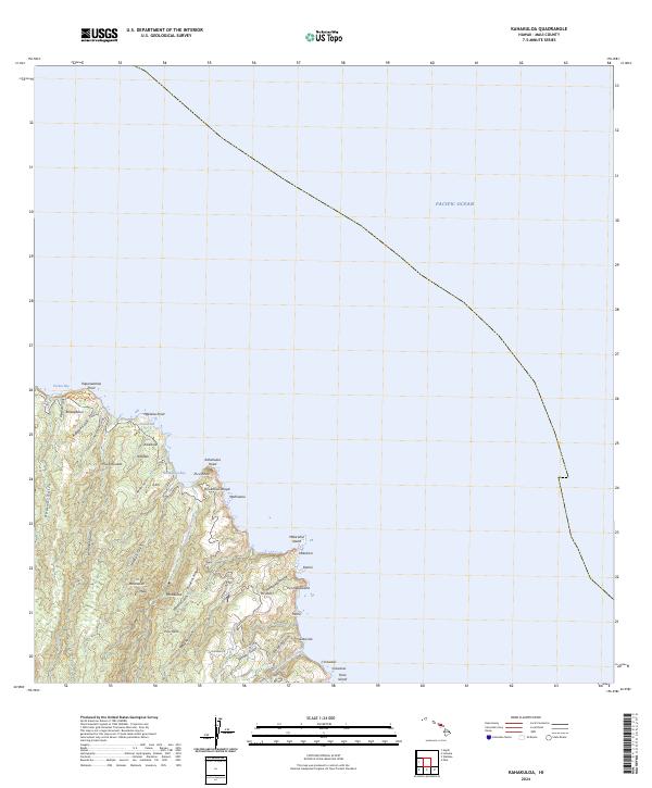
2024 Map of Kahakuloa
USGS Topo · Published 2024About this map
The northern coastline of Maui is defined by sharp ridges and deep gulches in this recent topographic survey. Centered on Kahakuloa Bay, the landscape transitions from the heights of Maunakini and the spine of Kaukini Ridge down to the water at Papanalahoa Point. Small coastal settlements and place names such as Mahinanui, Hononana, and Hauʖnaa are clustered near the sea, connected by a network of drainage features like Makamakaʖole Stream and Kahakuloa Stream.
Find a feature on this map
44 named features on this map. Tap any name to fly to it.
Don’t see what you’re looking for? This feature index may not catch every label — zoom into the map to look around manually.
Map Details
Editions of this 2024 Kahakuloa Map
This is the sole edition of this map. No revisions or reprints were ever made.
Other maps of this area

1954 · Maui
USGS Topo · 1:250,000

1954 · Paia
USGS Topo · 1:24,000

1955 · Wailuku
USGS Topo · 1:24,000

1955 · Kahakuloa
USGS Topo · 1:24,000

1956 · Lahaina
USGS Topo · 1:24,000

1956 · Honolua
USGS Topo · 1:24,000

1966 · Maui
USGS Topo · 1:250,000

1974 · Maui
USGS Topo · 1:250,000
1977 · Paia
USGS Topo · 1:24,000

1977 · Wailuku
USGS Topo · 1:24,000