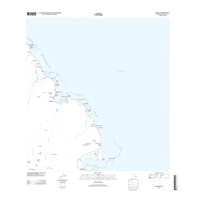
2013 Map of Kahana
USGS Topo · Published 2013About this map
Huilua Pond and Mōli'i Pond represent the enduring coastal engineering of O'ahu along the windward shore, where the sea meets the steep rises of the Ko'olau Range. This 2013 survey of the Kahana quadrangle captures a landscape defined by deep-cut valleys and narrow coastal plains, from the settlement of Papa'akoko in the north down to Waikāne in the south. The area’s history is etched into the terrain at the Kualoa Sugar Mill Beach and the expansive Kualoa Ranch, which sits between the peaks of Pu'ukānehoalani and the waters of Kāne'ohe Bay. Inland, the Waiāhole Ditch Tunnel and Waikāne Camp reflect the significant water-management and agricultural labor infrastructure that supported the region. Notable landmarks like the Crouching Lion rock formation and Mokoli'i Island serve as distinct visual anchors for this stretch of the Pacific coast.
Find a feature on this map
73 named features on this map. Tap any name to fly to it.
Don’t see what you’re looking for? This feature index may not catch every label — zoom into the map to look around manually.
Map Details
Editions of this 2013 Kahana Map
This is the sole edition of this map. No revisions or reprints were ever made.
Other maps of this area

1952 · Mokapu
USGS Topo · 1:24,000

1953 · Hauula
USGS Topo · 1:24,000

1954 · Oahu
USGS Topo · 1:250,000

1954 · Kahuku
USGS Topo · 1:24,000

1954 · Kahana
USGS Topo · 1:24,000

1954 · Kaneohe
USGS Topo · 1:24,000

1954 · Waipahu
USGS Topo · 1:24,000

1959 · Mokapu
USGS Topo · 1:24,000

1959 · Kaneohe
USGS Topo · 1:24,000

1959 · Waipahu
USGS Topo · 1:24,000