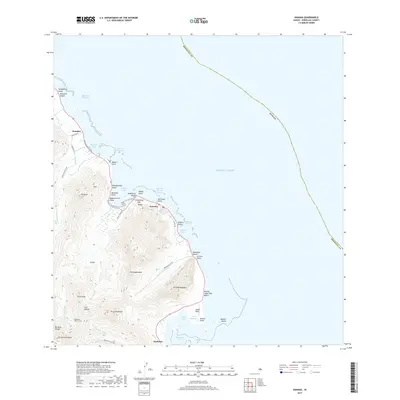
2017 Map of Kahana
USGS Topo · Published 2017About this map
Waikāne and the coastal settlements of windward O'ahu are presented here against the dramatic backdrop of the Ko'olau Range. This 2017 study details the interface between the steep peaks of Pu'u'ōhulehule and the Pacific, where narrow valleys like Punaluu Valley and Kaawa Valley provide the primary corridor for human habitation along Route 83. The map documents significant traditional and industrial landmarks, including the historical 'Apua Fishpond and Mōli'i Pond near Kāne'ohe Bay, and the site of Kualoa Sugar Mill Beach.
Find a feature on this map
59 named features on this map. Tap any name to fly to it.
Don’t see what you’re looking for? This feature index may not catch every label — zoom into the map to look around manually.
Map Details
Editions of this 2017 Kahana Map
This is the sole edition of this map. No revisions or reprints were ever made.
Other maps of this area

1952 · Mokapu
USGS Topo · 1:24,000

1953 · Hauula
USGS Topo · 1:24,000

1954 · Oahu
USGS Topo · 1:250,000

1954 · Kahuku
USGS Topo · 1:24,000

1954 · Kahana
USGS Topo · 1:24,000

1954 · Kaneohe
USGS Topo · 1:24,000

1954 · Waipahu
USGS Topo · 1:24,000

1959 · Mokapu
USGS Topo · 1:24,000

1959 · Kaneohe
USGS Topo · 1:24,000

1959 · Waipahu
USGS Topo · 1:24,000