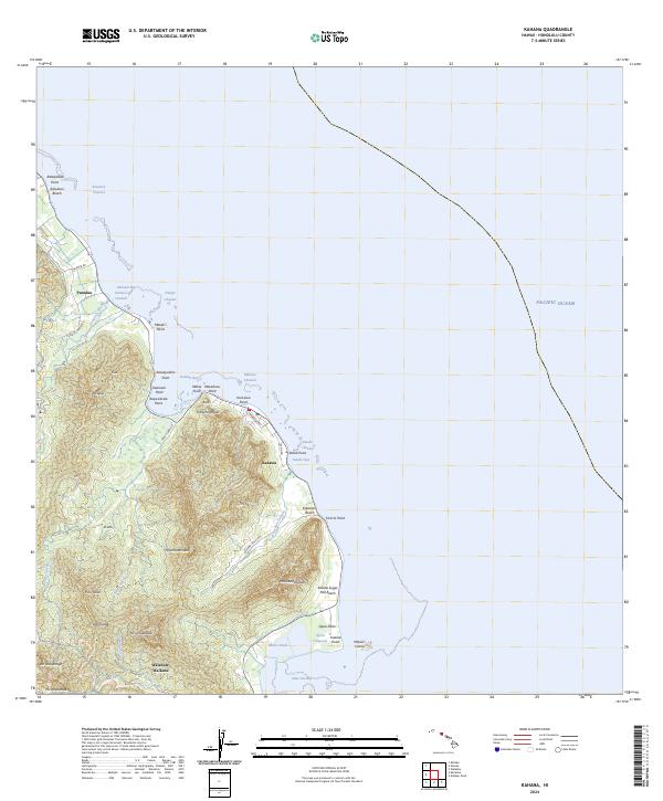
2024 Map of Kahana
USGS Topo · Published 2024About this map
The windward coast of Oahu reveals a complex landscape of narrow coastal plains and the sharp ridges of the Ko'olau Range. Modern settlements like Punaluu and Kaaaawa are concentrated along the shoreline, connected by the coastal corridor of Koolau Rd. Significant historical and cultural markers define the shoreline, including the ancient Mōli'i Pond and the 'Āpua Fishpond, reflecting traditional Hawaiian land use alongside the industrial memory of Kualoa Sugar Mill Beach.
Find a feature on this map
55 named features on this map. Tap any name to fly to it.
Don’t see what you’re looking for? This feature index may not catch every label — zoom into the map to look around manually.
Map Details
Editions of this 2024 Kahana Map
This is the sole edition of this map. No revisions or reprints were ever made.
Other maps of this area

1952 · Mokapu
USGS Topo · 1:24,000

1953 · Hauula
USGS Topo · 1:24,000

1954 · Oahu
USGS Topo · 1:250,000

1954 · Kahuku
USGS Topo · 1:24,000

1954 · Kahana
USGS Topo · 1:24,000

1954 · Kaneohe
USGS Topo · 1:24,000

1954 · Waipahu
USGS Topo · 1:24,000

1959 · Mokapu
USGS Topo · 1:24,000

1959 · Kaneohe
USGS Topo · 1:24,000

1959 · Waipahu
USGS Topo · 1:24,000