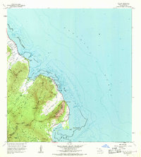
1967 Map of Kahana
USGS Topo · Published 1968About this map
The coastal settlements of Kaaawa and Kahana define the windward shoreline of Oahu during the late 1960s. This survey illustrates a landscape where the Koolau Range drops sharply into the sea, forming the dramatic backdrop for landmarks like Crouching Lion (Kauhi) and Puu Kanehoalani. The map documents early-century agricultural remnants alongside mid-century conservation efforts, specifically within the Kahana Valley State Park and Kaawa Forest Reserve. Significant maritime and cultural features are recorded, including the ancient stone-walled Huilua Pond and Molii Pond near Kualoa Point. Inland, a complex network of aqueducts, tunnels, and a Gaging Station trace the critical management of freshwater from the Punaluu Stream and Waikane Stream systems. Farther south, Waikane Camp and the Sugar Mill (Ruin) Chimney stand as physical evidence of the area's plantation history.
Find a feature on this map
45 named features on this map. Tap any name to fly to it.
Don’t see what you’re looking for? This feature index may not catch every label — zoom into the map to look around manually.
Map Details
Editions of this 1967 Kahana Map
This is the sole edition of this map. No revisions or reprints were ever made.
Other maps of this area

1952 · Mokapu
USGS Topo · 1:24,000

1953 · Hauula
USGS Topo · 1:24,000

1954 · Oahu
USGS Topo · 1:250,000

1954 · Kahuku
USGS Topo · 1:24,000

1954 · Kahana
USGS Topo · 1:24,000

1954 · Kaneohe
USGS Topo · 1:24,000

1954 · Waipahu
USGS Topo · 1:24,000

1959 · Mokapu
USGS Topo · 1:24,000

1959 · Kaneohe
USGS Topo · 1:24,000

1959 · Waipahu
USGS Topo · 1:24,000