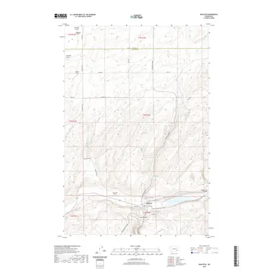
2020 Map of Kahlotus
USGS Topo · Published 2020About this map
Kahlotus sits at the junction of the Washtucna Coulee and Devils Canyon, serving as a central hub for this corner of Franklin County. The landscape is defined by the deep glacial meltwater channels of the Channeled Scablands, evidenced by features like Lake Kahlotus and the high elevations of Michigan Prairie. Transportation and recreation intersect here, as the Columbia Plateau State Park Trail follows a former rail grade through the heart of the settlement. For those tracing the area's development, the map details a network of rural roads such as Wadsworth Rd and Kahlotus Lind Rd that service private airstrips like Watson Airport and Angel Park Airport. Small water features, including Rainbow Spring and Lost Lake, dot the draws and coulees, while the Lakeview Cem provides a point of genealogical interest just north of the town center.
Find a feature on this map
38 named features on this map. Tap any name to fly to it.
Don’t see what you’re looking for? This feature index may not catch every label — zoom into the map to look around manually.
Map Details
Editions of this 2020 Kahlotus Map
This is the sole edition of this map. No revisions or reprints were ever made.
Other maps of this area

1916 · Connell
USGS Topo · 1:125,000

1918 · Connell
USGS Topo · 1:125,000

1923 · Washtucna
USGS Topo · 1:62,500

1925 · Washtucna
USGS Topo · 1:62,500

1948 · Ayer
USGS Topo · 1:62,500

1950 · Haas
USGS Topo · 1:62,500

1953 · Walla Walla
USGS Topo · 1:250,000

1958 · Walla Walla
USGS Topo · 1:250,000
1970 · Burr Canyon
USGS Topo · 1:24,000
1970 · Lower Monumental Dam
USGS Topo · 1:24,000