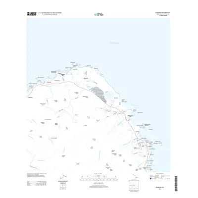
2013 Map of Kahuku
USGS Topo · Published 2013About this map
Marconi and Lā'ie anchor this northernmost reach of O'ahu during the early 21st century. The landscape is defined by the transition from the steep, carved gulches of the Ko'olau Range, such as Ho'olapa Gulch and Lamaloa Gulch, to the coastal plains and beaches. Along the windward shore, the map details numerous points and bays, from the prominent Kahuku Point to the recreational areas of Turtle Bay and Kuilima Golf Course. In Lā'ie, the street grid is clearly established, serving as a hub for the surrounding coastal community near the historic Lā'ie Landing. The presence of Cane Haul Rd and various plantation-era road names like Plantation Rd reflects the agricultural legacy that shaped the region before the rise of modern residential and resort development.
Find a feature on this map
124 named features on this map. Tap any name to fly to it.
Don’t see what you’re looking for? This feature index may not catch every label — zoom into the map to look around manually.
Map Details
Editions of this 2013 Kahuku Map
This is the sole edition of this map. No revisions or reprints were ever made.
Other maps of this area

1952 · Waimea
USGS Topo · 1:24,000

1953 · Haleiwa
USGS Topo · 1:24,000

1953 · Hauula
USGS Topo · 1:24,000

1954 · Oahu
USGS Topo · 1:250,000

1954 · Kahuku
USGS Topo · 1:24,000

1954 · Kahana
USGS Topo · 1:24,000

1960 · Haleiwa
USGS Topo · 1:24,000

1961 · Oahu
USGS Topo · 1:250,000

1965 · Oahu
USGS Topo · 1:250,000
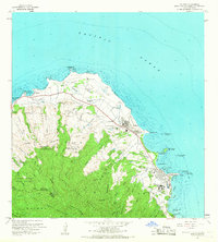
1965 · Kahuku
USGS Topo · 1:24,000