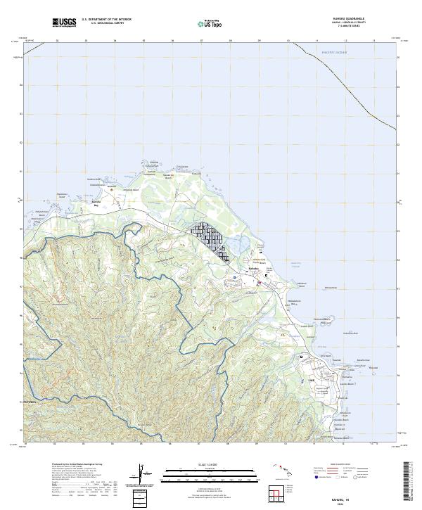
2024 Map of Kahuku
USGS Topo · Published 2024About this map
The northernmost reach of O'ahu is defined by the sharp corner of Kahuku Point and the complex wetlands of the James Campbell National Wildlife Refuge. The settlement of Kahuku serves as a central hub, situated between the recreational grounds of the Kahuku Golf Course Beach and the inland operations of the Kahuku Training Area. Along the coast, Turtle Bay and Kuilima Cove mark the transition toward the windward side, where Laie serves as a prominent community center. This area is noted for its cultural and educational landmarks, most notably the campus of Brigham Young University Hawaii. The landscape is deeply incised by gulches such as Malaekahana Stream and Kahawainui Gulch, reflecting the drainage patterns from the inland ridges toward the Pacific Ocean. Local history is preserved in sites like the Kahuku Japanese Cem and Laie Cem.
Find a feature on this map
119 named features on this map. Tap any name to fly to it.
Don’t see what you’re looking for? This feature index may not catch every label — zoom into the map to look around manually.
Map Details
Editions of this 2024 Kahuku Map
This is the sole edition of this map. No revisions or reprints were ever made.
Other maps of this area

1952 · Waimea
USGS Topo · 1:24,000

1953 · Haleiwa
USGS Topo · 1:24,000

1953 · Hauula
USGS Topo · 1:24,000

1954 · Oahu
USGS Topo · 1:250,000

1954 · Kahuku
USGS Topo · 1:24,000

1954 · Kahana
USGS Topo · 1:24,000

1960 · Haleiwa
USGS Topo · 1:24,000

1961 · Oahu
USGS Topo · 1:250,000

1965 · Oahu
USGS Topo · 1:250,000
1965 · Kahuku
USGS Topo · 1:24,000