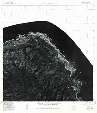
1977 Map of Kahuku
USGS Topo · Published 1984About this map
The northernmost tip of Oahu is captured in this orthophotomap, showing the coastal landscape as it existed in the late 1970s. This aerial-based survey provides a visual record of the shoreline from Kahuku Point down to the settlement of Laie. Unlike traditional topographic maps, this imagery reveals the actual ground cover, agricultural patterns, and building footprints within the community of Kahuku. The rocky coastline and prominent headlands like Makahoa Point meet the Pacific Ocean, offering researchers a clear look at the physical environment before further modern development. This document is particularly valuable for seeing the exact distribution of residential structures and open fields during this era.
Find a feature on this map
5 named features on this map. Tap any name to fly to it.
Don’t see what you’re looking for? This feature index may not catch every label — zoom into the map to look around manually.
Map Details
Editions of this 1977 Kahuku Map
This is the sole edition of this map. No revisions or reprints were ever made.
Other maps of this area

1952 · Waimea
USGS Topo · 1:24,000

1953 · Haleiwa
USGS Topo · 1:24,000

1953 · Hauula
USGS Topo · 1:24,000

1954 · Oahu
USGS Topo · 1:250,000

1954 · Kahuku
USGS Topo · 1:24,000

1954 · Kahana
USGS Topo · 1:24,000

1960 · Haleiwa
USGS Topo · 1:24,000

1961 · Oahu
USGS Topo · 1:250,000

1965 · Oahu
USGS Topo · 1:250,000
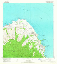
1965 · Kahuku
USGS Topo · 1:24,000