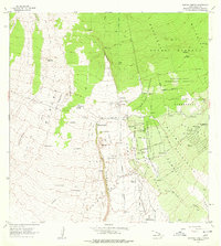
1962 Map of Kahuku Ranch
USGS Topo · Published 1977About this map
Kahuku Ranch anchors a landscape defined by sequential volcanic activity on the southern slopes of Hawaii. This survey details the extensive Lava Flow of 1868, Lava Flow of 1907, and Lava Flow of 1887, which have shaped the island's topography and dictated the boundaries of agricultural and residential land. The map reveals how human settlement adapts to this geology, with the Kiolakaa-Keaa Homesteads and Kamaoa Homesteads partitioned across the less affected terrain.
Find a feature on this map
64 named features on this map. Tap any name to fly to it.
Don’t see what you’re looking for? This feature index may not catch every label — zoom into the map to look around manually.
Map Details
Editions of this 1962 Kahuku Ranch Map
2 editions found
Other maps of this area

1924 · Kalae
USGS Topo · 1:62,500

1924 · Honuapo
USGS Topo · 1:62,500

1928 · Hoopuloa
USGS Topo · 1:62,500

1954 · Hawaii South
USGS Topo · 1:250,000

1959 · Hawaii South
USGS Topo · 1:250,000

1961 · Hawaii South
USGS Topo · 1:250,000

1962 · Hawaii South
USGS Topo · 1:250,000

1962 · Puu Hou
USGS Topo · 1:24,000

1962 · Kahuku Ranch
USGS Topo · 1:24,000

1962 · Pohue Bay
USGS Topo · 1:24,000