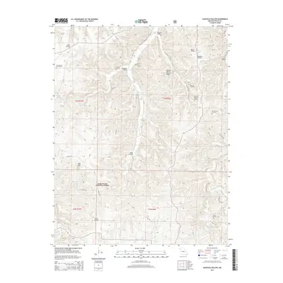
2015 Map of Kaintuck Hollow
USGS Topo · Published 2015About this map
Mark Twain National Forest dominates this section of the Ozarks, where the terrain is defined by a complex network of narrow drainages and significant karst features. The landscape is characterized by prominent hollows such as Smith Hollow, Hardester Hollow, and Deep Hollow, alongside notable geological formations like the Kaintuck Hollow Natural Bridge and King Sink. These features illustrate the deep-cut topography typical of the Phelps County region, where water sources like Elm Spring and Wilkins Spring emerged as vital points for early local development.
Find a feature on this map
37 named features on this map. Tap any name to fly to it.
Don’t see what you’re looking for? This feature index may not catch every label — zoom into the map to look around manually.
Map Details
Editions of this 2015 Kaintuck Hollow Map
This is the sole edition of this map. No revisions or reprints were ever made.
Other maps of this area

1912 · Rolla
USGS Topo · 1:62,500

1936 · Waynesville
USGS Topo · 1:48,000

1937 · Edgar Springs
USGS Topo · 1:48,000

1941 · Big Piney
USGS Topo · 1:62,500

1942 · Waynesville
USGS Topo · 1:62,500

1943 · Big Piney
USGS Topo · 1:62,500

1944 · Waynesville
USGS Topo · 1:62,500

1945 · Edgar Springs
USGS Topo · 1:62,500

1949 · Rolla
USGS Topo · 1:250,000

1950 · Newburg
USGS Topo · 1:24,000