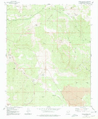
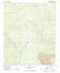
1980 Map of Kaiser Spring
USGS Topo · Published 1980About this map
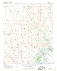
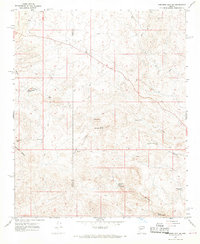
Burro Creek carves a deep path through this Mohave County landscape, separating the Aquarius Mountains and Aquarius Cliffs in the north from the Poachie Range to the south. The 1970s field data shows a region defined by its water sources and mining history, with the Burro Mine and Granite State Mine positioned among the high desert terrain. Local ranching and travel are marked by the presence of Shipp Ranch and a network of jeep trails connecting isolated points like Andys Hole and Hells Half Acre.
Find a feature on this map
34 named features on this map. Tap any name to fly to it.
Don’t see what you’re looking for? This feature index may not catch every label — zoom into the map to look around manually.
Map Details
Editions of this 1980 Kaiser Spring Map
2 editions found
Other maps of this area

1923 · Signal
USGS Topo · 1:250,000

1942 · Signal
USGS Topo · 1:250,000

1950 · Prescott
USGS Topo · 1:250,000

1954 · Prescott
USGS Topo · 1:250,000

1958 · Prescott
USGS Topo · 1:250,000

1959 · Prescott
USGS Topo · 1:250,000

1960 · Prescott
USGS Topo · 1:250,000

1965 · Prescott
USGS Topo · 1:250,000
1966 · Artillery Peak
USGS Topo · 1:62,500
1967 · Arrastra Mtn NE
USGS Topo · 1:24,000