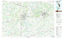
1982 Map of Kalamazoo
USGS Topo · Published 1983About this map
The Kalamazoo River anchors this regional landscape, winding westward through the industrial and academic hubs of Kalamazoo and Battle Creek. By the early 1980s, the area had developed into a complex network of manufacturing centers and educational institutions, most notably Western Michigan University and Kalamazoo College. The map reveals a high concentration of public lands and conservation areas, including the expansive Michigan National Guard Reservation and the adjacent Fort Custer State Park.
Find a feature on this map
135 named features on this map. Tap any name to fly to it.
Don’t see what you’re looking for? This feature index may not catch every label — zoom into the map to look around manually.
Map Details
Editions of this 1982 Kalamazoo Map
This is the sole edition of this map. No revisions or reprints were ever made.
Other maps of this area

1914 · Three Rivers
USGS Topo · 1:62,500

1916 · Three Rivers
USGS Topo · 1:62,500

1916 · Kalamazoo
USGS Topo · 1:62,500

1918 · Kalamazoo
USGS Topo · 1:62,500

1918 · Battle Creek
USGS Topo · 1:62,500

1918 · Union City
USGS Topo · 1:62,500

1918 · Galesburg
USGS Topo · 1:62,500

1918 · Leonidas
USGS Topo · 1:62,500

1921 · Marshall
USGS Topo · 1:62,500

1922 · Schoolcraft
USGS Topo · 1:62,500