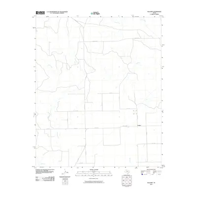
2010 Map of Kalgary
USGS Topo · Published 2010About this map
The small settlement of Kalgary sits at a remote crossroads in Crosby County, serving as a focal point for the surrounding cattle country and agricultural lands. This part of the Texas South Plains is defined by a dendritic network of intermittent drainages, most notably McDonald Creek and Yankee Creek, which carve subtle relief into the flat caprock terrain. The survey captures a landscape organized by a rigorous grid of county roads and key state-maintained routes like Ranch Rd 651 and Ranch Rd 261. While the community is centered near the junction of Co Rd 236 and Co Rd 225, the map details the broader area including Turkey Creek to the west and Bull Creek to the south. These features highlight the importance of water sources in a region dominated by ranching interests and expansive rural sections.
Find a feature on this map
25 named features on this map. Tap any name to fly to it.
Don’t see what you’re looking for? This feature index may not catch every label — zoom into the map to look around manually.
Map Details
Editions of this 2010 Kalgary Map
This is the sole edition of this map. No revisions or reprints were ever made.
Other maps of this area

1954 · Lubbock
USGS Topo · 1:250,000

1961 · Bunker Hill
USGS Topo · 1:24,000

1962 · Twomile Creek
USGS Topo · 1:24,000

1962 · Smith Tank
USGS Topo · 1:24,000

1966 · Kalgary
USGS Topo · 1:24,000

1966 · Collett Springs
USGS Topo · 1:24,000

1966 · Canyon Valley
USGS Topo · 1:24,000

1967 · Ralls SE
USGS Topo · 1:24,000

1969 · Verbena
USGS Topo · 1:24,000

1969 · Cap Rock SE
USGS Topo · 1:24,000