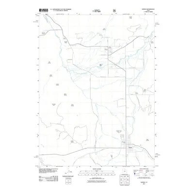
2011 Map of Kamas
USGS Topo · Published 2011About this map
Kamas Valley serves as the central hub of this 2011 survey, where the Weber River and several of its tributaries, including Beaver Creek and Thorn Creek, converge. The settlement of Kamas is anchored by the Kamas Post Office and surrounded by a network of local roads such as Garff Ranch Rd and Wooden Shoe Ln. The landscape is defined by its dramatic elevation changes, moving from the valley floor into the surrounding heights of The West Hills and Maple Ridge.
Find a feature on this map
55 named features on this map. Tap any name to fly to it.
Don’t see what you’re looking for? This feature index may not catch every label — zoom into the map to look around manually.
Map Details
Editions of this 2011 Kamas Map
This is the sole edition of this map. No revisions or reprints were ever made.
Other maps of this area

1885 · Salt Lake
USGS Topo · 1:250,000

1900 · Coalville
USGS Topo · 1:125,000

1903 · Coalville
USGS Topo · 1:125,000

1954 · Salt Lake City
USGS Topo · 1:250,000

1955 · Heber
USGS Topo · 1:24,000

1955 · Park City East
USGS Topo · 1:24,000

1958 · Salt Lake City
USGS Topo · 1:250,000

1960 · Salt Lake City
USGS Topo · 1:250,000

1967 · Francis
USGS Topo · 1:24,000

1967 · Kamas
USGS Topo · 1:24,000