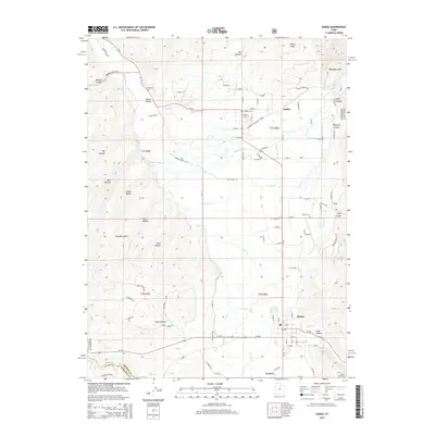
2014 Map of Kamas
USGS Topo · Published 2014About this map
The Weber River winds through the high meadows of the Kamas Valley, serving as the central geographic feature of this 2014 survey. The settlements of Kamas, Oakley, and Francis anchor the agricultural landscape, connected by Ut-32 and a network of rural roads such as Garff Ranch Rd and Wooden Shoe Ln. This region of Summit County exhibits a transition from the valley floor to the timbered slopes of the Wasatch Nat For, where the terrain is carved by numerous drainages like Seymour Canyon and Indian Hollow. Genealogy researchers will find significant value in the distribution of local burial grounds, including Peoa Cem, Oakley Cem, Stevens Cem, and Marion Cem, which highlight the historical community clusters across the quadrangle.
Find a feature on this map
82 named features on this map. Tap any name to fly to it.
Don’t see what you’re looking for? This feature index may not catch every label — zoom into the map to look around manually.
Map Details
Editions of this 2014 Kamas Map
This is the sole edition of this map. No revisions or reprints were ever made.
Other maps of this area

1885 · Salt Lake
USGS Topo · 1:250,000

1900 · Coalville
USGS Topo · 1:125,000

1903 · Coalville
USGS Topo · 1:125,000

1954 · Salt Lake City
USGS Topo · 1:250,000

1955 · Heber
USGS Topo · 1:24,000

1955 · Park City East
USGS Topo · 1:24,000

1958 · Salt Lake City
USGS Topo · 1:250,000

1960 · Salt Lake City
USGS Topo · 1:250,000

1967 · Francis
USGS Topo · 1:24,000

1967 · Kamas
USGS Topo · 1:24,000