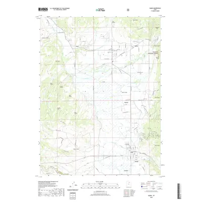
2020 Map of Kamas
USGS Topo · Published 2020About this map
The Kamas Valley serves as the central pastoral corridor of this Summit County region, anchoring a string of agricultural and residential communities including Kamas, Marion, Oakley, Francis, and Peoa. The landscape is defined by the winding course of the Weber River and its numerous tributaries such as Beaver Cr and Crooked Cr, which drain the surrounding highlands of The West Hills and the edges of the Wasatch National Forest. For genealogists and local historians, the map identifies several significant burial sites, including Peoa Cem, Oakley Cem, and Kamas Cem, alongside the Kamas Bible Church. Modern recreational development is evident in the complex trail networks east of Kamas, featuring names like Hsr Super Flow and Hsr Upper Downhill, which contrast with the traditional canyon and hollow names like Browns Canyon and Hoyt Canyon.
Find a feature on this map
78 named features on this map. Tap any name to fly to it.
Don’t see what you’re looking for? This feature index may not catch every label — zoom into the map to look around manually.
Map Details
Editions of this 2020 Kamas Map
This is the sole edition of this map. No revisions or reprints were ever made.
Other maps of this area

1885 · Salt Lake
USGS Topo · 1:250,000

1900 · Coalville
USGS Topo · 1:125,000

1903 · Coalville
USGS Topo · 1:125,000

1954 · Salt Lake City
USGS Topo · 1:250,000

1955 · Heber
USGS Topo · 1:24,000

1955 · Park City East
USGS Topo · 1:24,000

1958 · Salt Lake City
USGS Topo · 1:250,000

1960 · Salt Lake City
USGS Topo · 1:250,000

1967 · Francis
USGS Topo · 1:24,000

1967 · Kamas
USGS Topo · 1:24,000