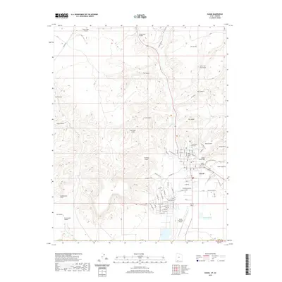
2020 Map of Kanab
USGS Topo · Published 2020About this map
Kanab sits at the base of the Vermilion Cliffs, serving as a gateway between the high plateaus and the desert floor. This 2020 topographic record shows the community's layout, from the Kane County Court House at the town center to the expansion of residential streets like Chinle Dr and S Hillside Dr. The landscape is defined by deep incisions in the earth, including Hog Canyon and Bunting Canyon, which drain toward the central corridor of Kanab Cr. To the south, the Kanab Municipal Airport and Spencer Number Two Reservoir mark the edge of the valley's developed floor.
Find a feature on this map
70 named features on this map. Tap any name to fly to it.
Don’t see what you’re looking for? This feature index may not catch every label — zoom into the map to look around manually.
Map Details
Editions of this 2020 Kanab Map
This is the sole edition of this map. No revisions or reprints were ever made.
Other maps of this area

1886 · Kanab
USGS Topo · 1:250,000

1886 · Kaibab
USGS Topo · 1:250,000

1953 · Cedar City
USGS Topo · 1:250,000

1953 · Grand Canyon
USGS Topo · 1:250,000

1954 · Kanab SW
USGS Topo · 1:24,000

1954 · Fredonia NW
USGS Topo · 1:24,000

1954 · Kanab SE
USGS Topo · 1:24,000

1954 · Shinarump NW
USGS Topo · 1:24,000

1954 · Johnson SW
USGS Topo · 1:24,000

1954 · Fredonia NE
USGS Topo · 1:24,000