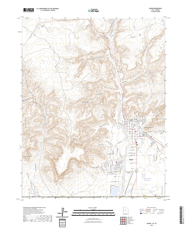
1980 Map of Kanab
USGS Topo · Published 1981About this map
White Cliffs and Vermilion Cliffs dominate this 1980 survey, illustrating the geological transition between the high plateaus and the canyon country of Southern Utah. This map shows the early expansion of Kanab near the Arizona border, alongside established corridor settlements like Orderville, Glendale, and Alton. The landscape is defined by the drainage of Kanab Creek and the East Fork Virgin River, with the Markagunt Plateau and Kolob Terrace rising to the north and west.
Find a feature on this map
66 named features on this map. Tap any name to fly to it.
Don’t see what you’re looking for? This feature index may not catch every label — zoom into the map to look around manually.
Map Details
Editions of this 1980 Kanab Map
This is the sole edition of this map. No revisions or reprints were ever made.
Historical Maps of Kanab Through Time
5 maps found